
The core idea
Waves transmit disturbances, currents transport water, and tides are periodic sea-level motions driven mainly by the Moon and Sun. Coastal shape also depends on the balance of sediment entering, leaving and remaining within a defined area.
1. Ocean water has properties that can change
Sea water contains dissolved salts. Evaporation removes water molecules while leaving most dissolved salts behind, so it can increase salinity. Rain and river inflow can dilute surface water. These statements describe processes; the measured salinity also depends on mixing and transport. An Indian estuary receiving monsoon river water therefore cannot be understood from evaporation alone. Salinity is a concentration, not the total amount of salt in an entire ocean.
Temperature and salinity influence density, with pressure also important at depth. Under comparable conditions, colder sea water is generally denser, and adding dissolved salt raises density. Density differences can help drive vertical and horizontal circulation. Surface winds transfer momentum to the ocean, Earth’s rotation deflects motion, and continents constrain pathways. Real circulation combines these influences; drawing a single arrow labelled “warm water rises” cannot explain every ocean current.
Sources: NCERT: Water and the hydrological cycle ↗ · NCERT: Movements of ocean water ↗
2. Separate a travelling wave from a current
Wind transfers energy to the water surface. A wave pattern travels while individual parcels mainly oscillate; in deep water their idealised paths are approximately circular. Thus a crest reaching a beach does not require one parcel to have travelled all the way from the distant wind. Real waves can produce net drift, and currents can carry water at the same time. “No water ever moves” would be an incorrect simplification.
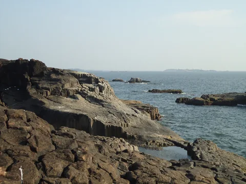
As waves enter shallower water, interaction with the bottom changes their speed and shape; breaking transfers energy and stirs sediment. A current, by contrast, is a net water flow in a direction over the chosen time interval. Tidal currents accompany changing tidal levels, but their timing depends on the setting. A photograph of one wave crest cannot reveal the local current speed or the day’s full tidal range.

Sources: NOAA: What causes ocean waves? ↗ · NCERT: Movements of ocean water ↗
3. Tides combine astronomical forcing and local response
The Moon’s gravitational pull differs across Earth: the near side is pulled more strongly than Earth’s centre, and the far side less strongly. This difference, rather than a uniform pull on the entire planet, helps explain the two-bulge tidal model. The Sun also exerts a tide-generating influence. Near new and full moon, their effects tend to reinforce, producing spring tides with a larger range; “spring” does not mean the season.
Near the quarter-moon phases, the combined forcing generally produces smaller-range neap tides. An ideal ocean-covered globe is only a starting model: real basins have continents, varying depths and their own responses. A place can have one main high tide each lunar day, measured relative to the Moon rather than the Sun, two similar highs, or two unequal highs. These patterns explain why one tide timetable cannot be copied to every Indian coastal town.
Sources: NOAA: What causes tides? ↗ · NOAA: Spring and neap tides ↗ · NOAA: Types of tides ↗
4. Worked case: range and residual are different
Take an illustrative gauge record with low water at 0.6 metre and the next high water at 3.4 metres, both above the same fixed reference level or datum. The tidal range for this pair is 3.4 − 0.6 = 2.8 metres. High-water height alone is not the range. If both heights were expressed above a datum one metre lower, they would become 1.6 and 4.4 metres; their difference would remain 2.8 metres.
At another illustrative instant, astronomical prediction is 2.5 metres and observed water level is 3.0 metres in the same datum. Observed minus predicted gives a +0.5-metre residual. Wind and atmospheric pressure can alter water levels, but this subtraction alone does not identify the entire cause; prediction, timing and measurement errors also need examination. These fictional values teach comparisons and are not a tide forecast or navigation information.
Sources: NOAA: Local effects on tides ↗ · NOAA: Types of tides ↗
5. A beach is connected to neighbouring places
When waves approach a shore obliquely, they can drive currents that transport sediment along the coast. Other motions exchange sand between the beach and offshore bars. Rivers, eroding cliffs and neighbouring beaches may supply material. The visible beach is therefore one store within a connected system. Sand leaving the dry beach need not have left the entire coastal system permanently; it may be stored offshore and later return under different conditions.
A structure that interrupts transport can change supplies elsewhere: local accumulation is not proof that the whole coast gained sediment. Shoreline position also depends on water level and the chosen mapping definition. Comparing photographs from different tides may create an apparent shoreline shift without proving an equal loss of beach material. Good evidence combines repeated measurements with a clear boundary, reference level and observation period.
Sources: USGS: Waves, tides and coastal change ↗ · USGS: Coastal sediment budgets ↗
6. Worked case: account for every sediment pathway
For a fictional coastal compartment during one year, suppose 1,000 cubic metres arrive alongshore and 100 arrive from a river. During the same year, 800 leave alongshore and 200 leave through another measured pathway. Assuming comparable bulk volumes and no unmeasured transfers, storage change is 1,000 + 100 − 800 − 200 = +100 cubic metres. Positive means more sediment remained inside the boundary; it does not mean every beach point grew equally.
This is a sediment budget, so tidal water flowing in and out must not be added as if it were sand. A negative balance would indicate net loss from the defined compartment. Uncertainty in several large inputs and outputs can overwhelm a small calculated remainder. Before explaining a real coast, test whether the sampling period represents seasonal variation and whether the offshore boundary misses an important exchange.
Keep a sediment budget separate from water levels
| Pathway in one year | Sediment volume |
|---|---|
| Alongshore input | +1,000 m³ |
| River input | +100 m³ |
| Alongshore output | −800 m³ |
| Other measured output | −200 m³ |
| Storage change | +100 m³ over one year |
Sources: USGS: Coastal sediment budgets ↗ · USGS: Waves, tides and coastal change ↗
PUT IT INTO PRACTICE
Practice: reason, calculate and check
- On paper, label a travelling wave, a net current and a changing tidal level; state what moves or changes in each.
- For illustrative heights 2.8 m and 0.4 m above one datum, calculate the range.
- Balance hypothetical sediment inputs of 500 and 80 m³ and an output of 650 m³ over the same interval.
- Check: a wave transmits a disturbance, a current transports water and tidal level rises or falls. Range is 2.4 m; storage change is −70 m³. Future beach position also depends on subsequent transport, water level and how sediment is distributed within the boundary.
Check your understanding
Does evaporation remove most dissolved sea salt with the water?
No. Most salts remain, so evaporation can concentrate the remaining solution. Mixing and freshwater inputs also matter.
Must a parcel travel from the storm to the beach with a wave crest?
No. A travelling pattern transfers energy while water largely oscillates; currents and wave-related drift can also transport water.
Are spring tides restricted to one season?
No. The name describes larger tidal ranges associated with the combined lunar and solar forcing near new and full moon.
Does changing the datum change the tidal range?
No, if both heights use the same new datum. Adding an equal offset to both leaves their difference unchanged.
Does a +0.5 m residual prove one specific cause?
No. It identifies a difference from prediction; physical influences and measurement or model limitations must be assessed.
Can a beach gain sand while a neighbour loses it?
Yes. Connected transport can redistribute material. A wider sediment budget is needed to distinguish redistribution from net addition.